Preikestolen (Pulpit Rock) from the water
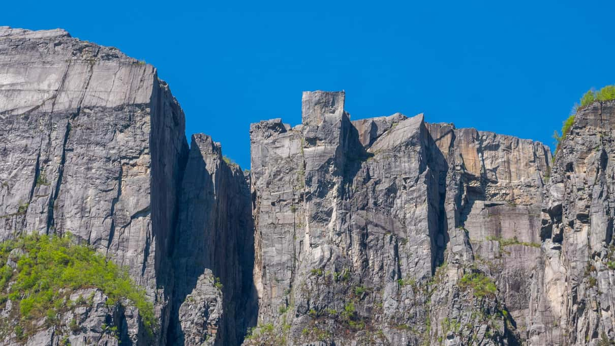
From the deck, Preikestolen is a sheer wall with a flat lid, 604 m (1,982 ft) straight up. You are looking at the edge the hikers stand on rather than standing on it yourself. Seeing it from below is a different experience from the hike, and on most schedules you have to choose one.
What you see from the deck
Preikestolen is a flat-topped cliff that rises 604 m straight out of the Lysefjord, nearly twice the height of the Eiffel Tower. From a boat you sit at its foot and look up the face to the sharp edge where people stand for their photos. The flat top itself, the platform hikers walk out onto, is out of sight from below. What you get instead is the whole height of the wall in one view, which the hikers at the top never see.
That scale is hard to judge at first, because nothing on the cliff gives you a reference. On a clear day the people on the rim help. They show up as specks of color against the sky, and once you spot one the size of the cliff suddenly makes sense. The guides on the big boats point out the rock as you approach, and on the RIBs the skipper-guide talks you through it.
Spotting hikers on the edge
Hikers on the rim are the detail most people remember. Bring binoculars if you own a small pair, or use the zoom on your phone. Bright jackets stand out best, so scan for spots of red or yellow. Summer brings the most hikers, while a winter weekday may leave the edge empty. A boat rarely holds perfectly still, so brace your elbows on the rail before you zoom in. Our photo guide covers lenses and settings for shooting upward from a moving deck.
How long the boats stay below the rock
None of the five main listings states an exact time at Preikestolen. Stavanger RIB plans about 45 minutes of sightseeing and wildlife once inside the fjord, spread over the three main sights. FjordEvents lists a 5-minute photo stop at Fantahålo, the Vagabond's Cave, which gives a feel for the pace on a RIB. Expect short pauses there rather than a long wait.
The longest published stop belongs to Brim Explorer's hybrid ship, which lists about 15 minutes at each of its main sights. It sails from May to August only, and reviewers note it turns about halfway into the fjord. On the year-round catamarans the whole trip moves at a gentler pace, and Rødne's 3.5 hours leave the most time for looking up.
Below the rock in 2.5 hours, ~$89
Helgøy's catamaran has an outdoor deck for looking up at Preikestolen and a heated lounge to retreat to afterward.
Hiking to the top instead
The hike starts at Preikestolen Fjellstue (also known as Preikestolhytta), the lodge at the trailhead. It is about 8 km (5 miles) there and back with roughly 330–350 m (1,080–1,150 ft) of climbing, and most people need about 4 hours for the round trip. The path is rocky with steep stretches and stone steps. The usual season runs from about April to October. In winter the trail can be icy and dark early, and guided winter hikes are the safer way up.
The trailhead lies across the water from Stavanger, reached by car through the road tunnels or, in season, by bus. Once you add the journey there and back, the hike fills most of a day. From the top, the tour boats look like toys on the water below. From the boats, the hikers look the same, which is a good reason to try both on separate days if you can.
Can you do both on a port day?
Rarely. Add the travel to the trailhead and a 4-hour hike to a boat trip of 2–3.5 hours, and the total runs past what most ships allow. A port call of eight or nine hours leaves no room for delays on either part, and a missed all-aboard is a steep price for one more view. On a ship, choose one. The boat is the safer fit, and our cruise guide shows how it slots into the day.
Staying in Stavanger changes the picture. With two days you can hike one day and take the boat the next, ideally with the boat first so you know what the cliff looks like from below. The season guide helps you pick the months when both work.
The Lysefjord bridge on the way
Before Preikestolen, Rødne and Fjord Xplore pass under the Lysefjord bridge, a suspension bridge near the fjord mouth that opened in 1997. The fjord is 42 km (26 miles) long but only about 13 m (43 ft) deep at its mouth near Forsand. Further in it drops to more than 400 m (1,300 ft), with walls rising about 1,000 m (3,300 ft) on either side. Preikestolen comes after Fantahålo, and Hengjanefossen follows it. None of these trips goes as far as Kjerag at 1,110 m (3,640 ft) or the village of Lysebotn at the inner end. The Lysefjord sights in order follows the full route.
When cloud hides the top
Low cloud and fog can sit on the rim while the water below stays clear. The boats sail anyway and you still see the lower face of the cliff. The edge may vanish, along with any hikers on it. A sunny forecast for Stavanger does not always mean a clear Lysefjord. Weather and cancellations explains what each operator does when conditions turn.
Choosing a boat for the view
- Most time to look up. Our pick, Rødne's electric catamaran from ~$92. It has a sun deck and passes under the bridge;
- An outdoor deck in 2.5 hours. Helgøy from ~$89, whose skipper also takes you very close to the waterfall;
- The lowest angle. On a RIB you sit near the waterline, so the cliff towers higher. Book FjordEvents from ~$124 or Stavanger RIB from ~$145, and expect short stops;
- A roof that opens. Fjord Xplore from ~$166 has a convertible sun-top for looking straight up, and it passes under the bridge as well;
- Still deciding on the boat type. RIB or cruise compares comfort, and the price guide compares fares.